THUNDER BAY — David Jackson will head out on July 4 for a month-long, 1,100 kilometre canoe expedition from Manitoba to Thunder Bay.
He's part of a small group assigned to a mapping project.
They'll be verifying the accuracy of preliminary information that's been collected for producing new, more detailed maps of the paddling route.
It's a process called ground truthing.
Jackson, who lives in Red Rock, is a coordinator with the Path of the Paddle Association, the volunteer organization that maintains the water segment of the Trans Canada Trail (also known as The Great Trail) through Northwestern Ontario.
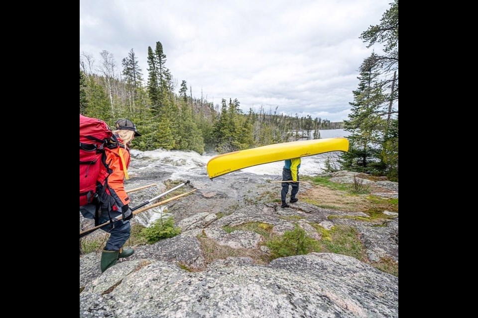
He and his companions should find the route's 152 portages in excellent shape.
That's because last summer and this spring about 10 trail stewards were hired to re-route some of the portages and overhaul sections that were difficult to traverse.
"Parts just really needed some loving. It's hard to lean on volunteers to do it all," Jackson told TBnewswatch.
Thanks to a $28,000 Trillium Foundation grant and support from Ontario Power Generation, he said, "We were able to make sure that it's going to be a great experience for paddlers" this year and beyond.
Due to ongoing flooding in the Kenora region, a couple of sections are currently under water and will have to be attended to later.
Path of the Paddle maintains six segments between Manitoba's Whiteshell Provincial Park and Fort William Historical Park.
Each section is monitored by volunteer regional trail committees.
Board chair Ember McKillop says "We are ensuring the trail continues to be world-class, enabling the association to create partnerships with local businesses and organization that also stand to benefit from the paddlers we hope to attract to the region."
Aside from the stretch through Quetico Park, the Path of the Paddle mostly goes over Crown land.
Jackson said that makes it ideal for families and people who are looking to avoid congested parks or save money on park fees.
"It's so expensive just to get there right now, with gas and food costs and so on. It's a great opportunity for people to go and connect with nature without having to buy park passes all the time, unless they do want to go through the Quetico section."
Jackson said the group has had a longstanding dream of making a "very thorough, detailed map so that people who want to go on the trail can purchase exact maps of campsites and portage information into a 1:20000 scale."
As part of that project, and with support from the Trans Canada Trail, he and three other people will spend 32 days this summer paddling the entirety of the water route.
"We're going to be ground truthing these new maps that we're making...so that when we put them up for sale next fall and winter, we're going to know that they're accurate and trustworthy maps."
The group will take copies of the draft maps with them so they can note any necessary corrections along the way.
A link to the existing route map is available.
