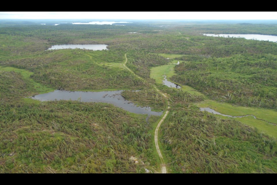
DRYDEN, Ont. — The Ministry of Natural Resources and Forestry will keep a close eye on a huge expanse of downed trees about 70 kilometres southwest of Dryden.
More than 20 square kilometres of forest was blown down on June 8 by an EF 2 tornado near Lawrence Lake and Brooks Lake.
After Western University's Northern Tornadoes Project released satellite imagery showing the extent of the damaged area, the MNRF dispatched an aircraft to take its own photographs.
The MNRF's photos show what Northwest Region Fire Response Coordinator Darren McLarty describes as "a patchwork of chopsticks."
Most of the thousands of downed trees are jackpine.
In an interview with tbnewswatch.com, McLarty said the tornado left "a notable scar" in the ministry's new Boundary Waters Forest Management Unit.
Blowdowns happen almost every year in Northwestern Ontario, and there have been even larger ones than this one.
McLarty said they pose a particularly serious fire hazard for the first few years, after conifers dry and before the forest regenerates.
In some cases, the MNRF may conduct prescribed burns on the perimeter to reduce the risk.
In other situations, downed trees can sometimes be salvaged for timber while at the same time reducing the fire risk.
However, McLarty noted that this isn't always a viable option because it may be too difficult to get harvesting equipment through the clutter on the forest floor.
For the same reason, he said, fighting fires in these areas can be especially dangerous for ground crews
If trees in a blowdown are too badly damaged to be used for timber, they may still be suitable for chips to make pulp.
The ministry's Fort Frances district office is expected to consider the feasibility of a salvage operation.
McLarty said the MNRF doesn't always hear about blowdowns, and counts on the public to help it keep track of them so they can be documented and monitored.
