MARTEN FALLS FIRST NATION, ON — A year after Premier Doug Ford's election campaign promise to "hop on that bulldozer" himself if necessary to build a road to the Ring of Fire, as yet no Caterpillars are rumbling through the forest north of Marten Falls First Nation.
The community, however, is launching a study under the Ontario Environmental Assessment Act for an all-weather route linking it to the provincial road network to the south.
That road could eventually be followed by a northward link to the Ring of Fire mineral zone.
A notice announcing work on terms of reference for the EA was published this week.
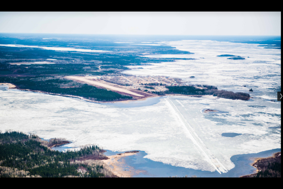
Marten Falls is a fly-in community with a registered population of 725, including 325 members living on-reserve. It is located at the junction of the Albany and Ogoki Rivers, 170 kilometres north of Nakina.
The engineering firm AECOM is coordinating the EA and doing the preliminary design for the proposed road.
A map of the study area shows two broad corridors are being considered for the initial road which would connect Marten Falls to forestry access roads near Painter Lake north of Nakina. If a decision is made later to continue to a second phase, an all-season supply road to the Ring of Fire will require a crossing of the Albany River.
Coalition formed to promote east-west route to Ring of Fire
In a related development, a group of stakeholders announced this week they have formed the East-West Ring of Fire Road Coalition to push for a route east from Highway 599 in the Pickle Lake area.
The group contends this would benefit the greatest number of communities and increase the range of economic opportunities associated with the Ring of Fire.
A news release did not include a list of the participants, but the coalition said it represents municipalities, First Nations communities and businesses in northwestern Ontario.
Sioux Lookout Mayor Doug Lawrance, who speaks for EWRFC, said the east-west route "would optimize existing road alignments, piggyback on pending hydro grid construction and use existing logistics and supply networks."
Lawrance added that the route "would lessen the environmental impacts and avoid expensive, problematic large-scale water crossings."
He said it would pass close to Cat Lake, Mishkeegogamang, Lac Seul, Webequie, Nibinamik Eabamatoong, Saugeen and Slate Falls First Nations.
