THUNDER BAY — Environment Canada's snowfall warning for the Thunder Bay area on Monday proved to be pretty accurate.
The forecast called for 10 to 25 centimetres, with the higher amounts possible in elevated terrain to the southwest of the city.
On Tuesday morning, a check of three monitoring stations in and around the city showed new snowfall accumulations ranging between 18 cm and 25 cm.
Thunder Bay Airport recorded 22 centimetres.
However, at a fourth monitoring station –in the southwest – 35 cm of snow was recorded.
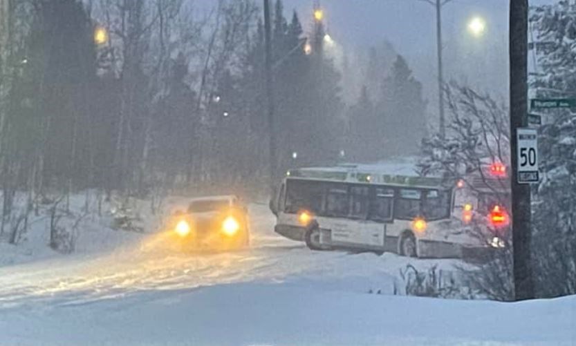
Motorists were challenged to navigate some Thunder Bay streets on Monday evening.
At about 10:45 pm, the City of Thunder Bay announced that transit buses had been pulled out of service because of difficult driving conditions.
The city's snow removal guidelines state:
After five centimetres of snowfall, our plows are out. We start snow plowing at 2 am on priority routes. This is to ensure that we keep emergency and transit routes open. They are often roads that have a lot of traffic. It takes about seven hours to clear these main routes.
Our snow-removal crews move to residential streets and secondary routes after 10 centimetres of snow is on the ground and we have cleared the priority routes. Clearing all residential streets can take up to 72 hours to complete.
A new weather system is expected to drop about 5 centimetres of snow on Thunder Bay on Tuesday night.
Environment Canada meteorologist Steven Flisfeder said there should be more snow on Thursday as well, but nothing nearly as significant as what Monday's storm brought.
