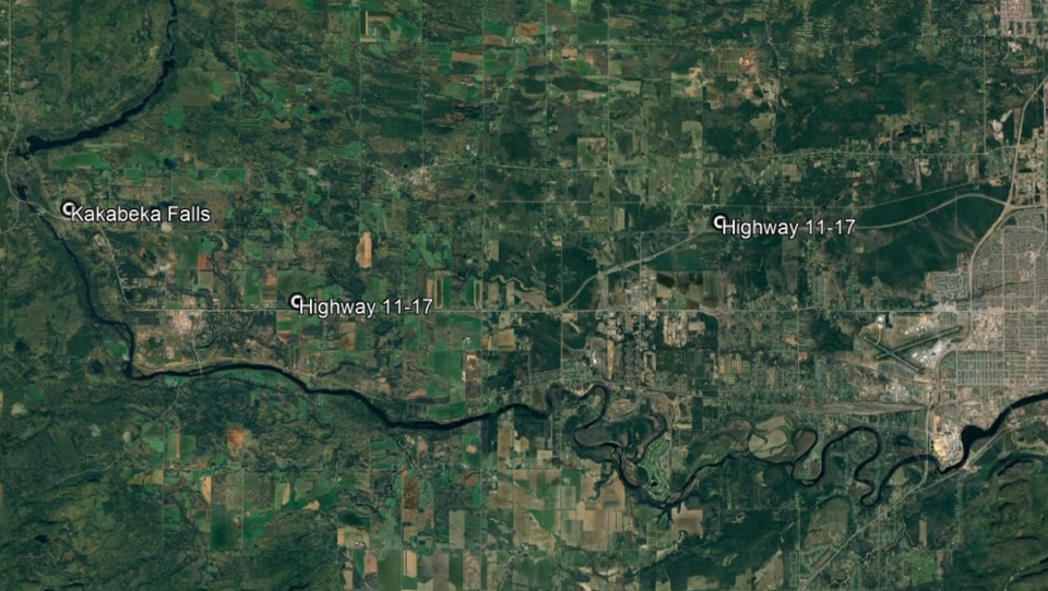
THUNDER BAY - The twinning of Highway 11/17 between Thunder Bay and Kakabeka Falls is another step toward becoming a reality.
The provincial government has started the preliminary design phase of the twinning project, a continuation of the work that began in the 1970s with establishing the designated route area.
“In this design stage, what they are looking for is establishing the route in that designated route area established in the 70s and looking at things like environmental assessment, alignment, structures required. At no means we are at a stage where we can announce a construction date,” said Thunder Bay – Atikokan MPP Kevin Holland.
“From there it will go into a secondary or final design stage, that will include the cost estimates for the project moving forward. But this is a critical step forward in seeing that section twinned.”
Holland added that traffic studies have also been completed, which show an anticipated increase in traffic volumes due to potential resource developments in Northwestern Ontario.
It will also address growing safety concerns for Northern Ontario drivers travelling through the region.
According to Holland, statistics given to him by the Ontario Provincial Police and Ministry of Transportation show traffic collisions on area highways are actually down, but that gives little solace to people who have experienced such incidents.
“Highway safety is always top of mind,” he said. “We want to make sure we are putting the process in place and moving forward on improving that safety. This will definitely address that as well as improve the flow of traffic and address the critical piece that there is no alternate route around that section.”
The establishment of the designated route area as part of the initial phase in the 1970s also included consultation with property owners in the area who may be affected.
“They did the consultation, the environmental assessment, they engaged with property owners on where the designated route would be,” Holland said. “After that process they have gone in and secured those properties and registered titles.”
This design phase will include establishing the specific route in the designated route area, as well as determining drainage, structural, and illumination needs, and environmental assessments.
Cost estimates will be considered during the next phase of the project.
